02/03/2021
Not a week goes by without another hiking route coming into being, and every new route that is opened offers varied and exciting opportunities for hiking/trekking lovers.
As a hiking volunteer who stays in Çanakkale-Eceabat Seddülbahir village in the summertime and as being a member of the Culture Routes Society at the same time, I immediately wanted to hike on the Troy Culture Route when I heard it came to life.
As you may also know spring months are the most convenient and fine times of the year for hiking/trekking on such routes. These months are the ideal times for most hikers, especially for the ones who hike with a camping load. While hiking you do not swelter, you do not sweat too much; nights are not too cold, moreover you can even have a swim on the routes that follow the seashore if you do not have a problem with swimming in cool waters. Again, some may know, there is nothing better than a cool sea to bring around and refresh an exhausted body and especially fatigued feet after a long hiking day.
I planned to hike on the Troy Culture Route in spring months with the same ideas at first. Later on, I thought that I could not wait until spring and I had to walk on this route as soon as possible. I decided to hike in the beginning of October. Thus, I would leave the scorching heats of the summer behind and I would seize the opportunity to swim since the weather has not got cold yet. Certainly things did not go as planned and my hiking plans were delayed due to a week of heavy rain. It was the 9th of October when the weather brightened up and became suitable for a hiking. I started to hike the Troy Culture Route on a sunny day of October 9th.
The route begins at the Troy Museum, the nominee for the European Museum of the year 2020 Award, which is also the only place from Turkey that was featured in the World’s Greatest Places of 2019 by the world famous Time magazine. This being the case, one should not walk the route which is called “Troy” without visiting the museum having the same name. However, I suggest the ones who would like to start hiking and to visit the museum within the same day to set off early in the morning because it needs at least 2-2.5 hours to visit the museum properly.
If you enter the museum at 11:30 and leave it 1.5 hours later after having an extremely accelerated tour on a day where the sun goes down at 18:45, then you will have 18 kms to go and only 5.5 hours left before it gets dark which means you have to walk quite fast in order to set up a tent and settle before the sunset.
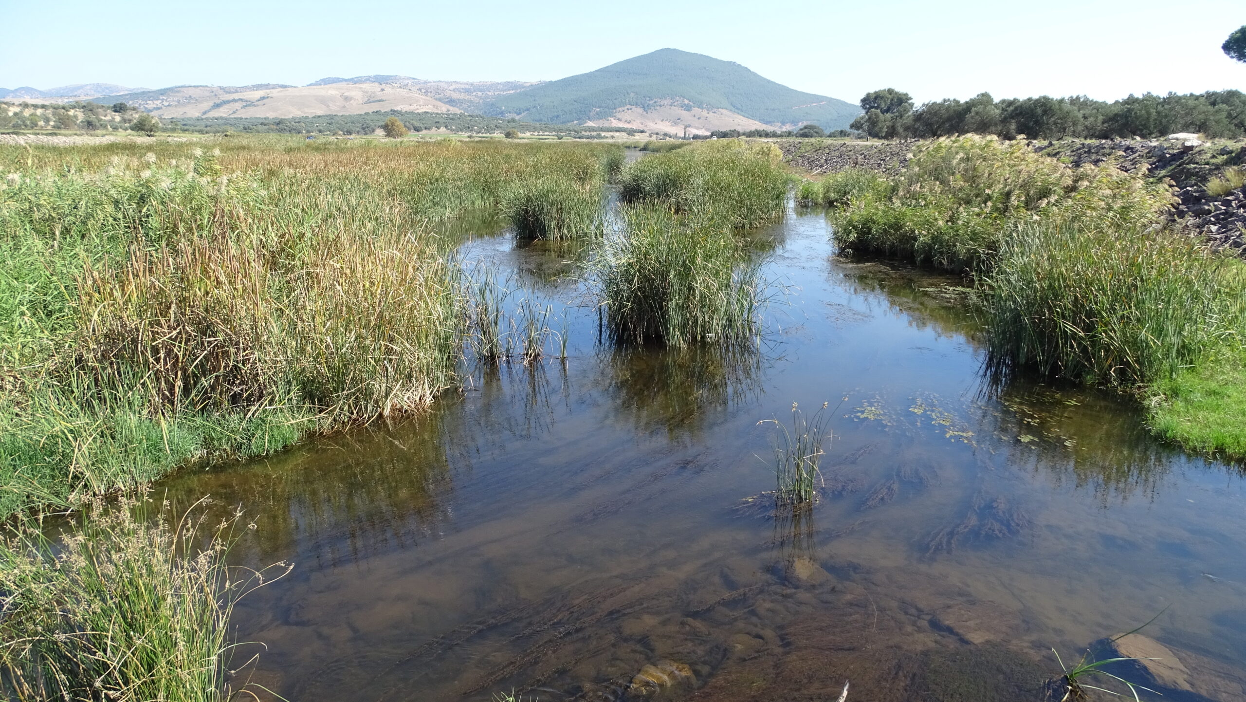
The route goes to Yeniköy by respectively passing through Çıplak and Kalafat villages and Batak plain after the museum. You generally walk on flat tracks starting from the beginning of the route until Yeniköy which enables you to reach your goal without expending too much energy for the first day.
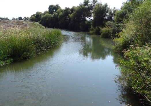
It is said that the river Karamenderes (ancient Skamander River) which divides the Batak plain into two may flood during the heavy rain season and drown the only circumjacent bridge where the route crosses. One week before I started to hike it was rainy and frankly speaking I was worried about whether the bridge was flooded or not. Thankfully the official webpage of the route and the official mobile application issue flood warnings. The river Karamenderes was quietly flowing while I was crossing the bridge and it did not cause any difficulties.
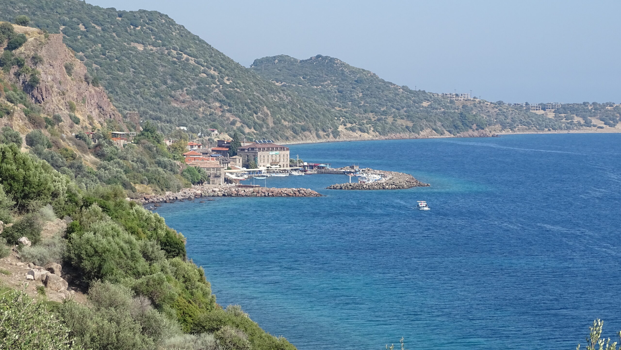
I completed the first day of my hiking in a camping ground by the sea with a running fountain just next to the Yeniköy port. The view of the setting sun into the Aegean Sea with Bozcada on the left and Gökçeada on the right made me forget the fatigue of the day.
The next day’s route starts from Yeniköy and goes to Geyikli by respectively passing through Üvecik and Bozköy which means you will gradually see the ruins of the ancient settlements. You can see Achilleion (the place of Achilles) from afar in the location called Beşik-Yassıtepe and you can see the Tumulus of Achilles also from afar in the location called Beşik-Sivritepe although the route does not immediately pass through these places. Subsequently, before coming to Üvecik you can see the Tumulus of Caracalla (the tomb of Festus) in the location called Üvecik Hill and after passing Bozköy you can see Hanaytepe – the greatest and the most important settlement in the Troas region apart from Troy.
In the first part of the route you follow the track back while going to Üvecik from Yeniköy because as a matter of fact it is the same track you walked while going to Yeniköy. When I started off from Yeniköy the next day, based on this knowledge and the previous day’s experience I did not pay very much attention to the waymarks and GPS records and diverged from the route a little. I was mad at myself at first when I realised it. However, thanks to this diversion, I understood that I came a bit closer to the location called Beşik-Sivritepe and consequently closer to the Tumulus of Achilles and my sadness was replaced by joy. If had more time I would like explore the tumulus closely but I could not do it. I had to carry on because there were too many roads to walk.
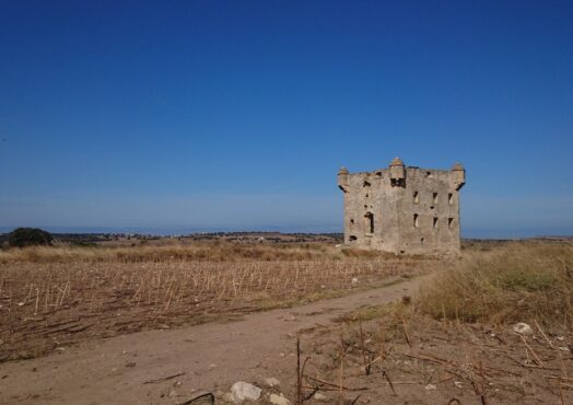
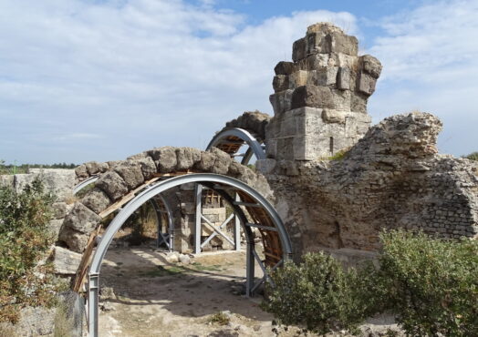
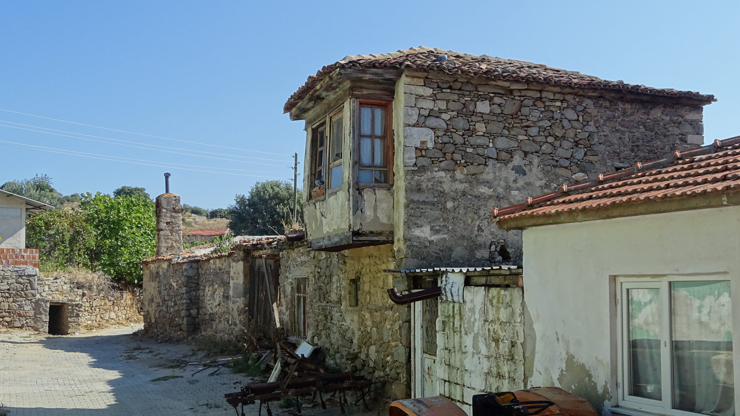
Another place of interest on the route is the Pavilion of Cezayirli (Algerian) Hasan Pasha or the ruins of the Pavilion. This location is also a junction where the track coming from Tevfikiye (the starting point) splits into two – one way to Yeniköy and the other way to Üvecik. Therefore you see the ruins of the Pavilion’s watchtower twice – once while going to Yeniköy and once while going to Üvecik from Yeniköy. I can say that the watchtower is quite photogenic in spite of all its destruction.
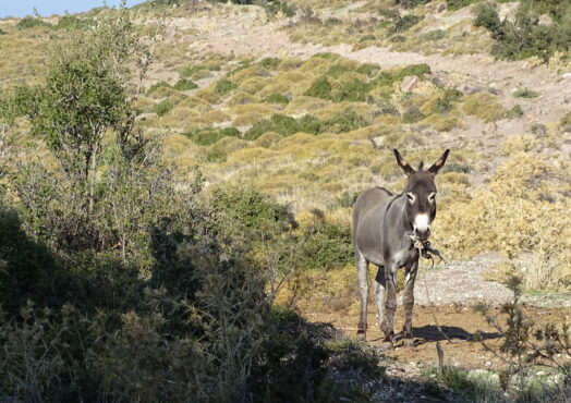
A largish dog tagged along behind me when I set off in Yeniköy at 9:00 in the morning. Its ears were cut presumably to avoid other big dogs’ attacks. The dog followed me until Üvecik. Whenever I had a break he stopped and whenever I started to walk he started to follow me from a distance since he was too timid. The poor dog walked with me for 12 kms. I bought some salami in Üvecik and tried to feed him but he did not even eat them because of his timidity. I guess he got tired of walking without any food and care and he stopped following me afterwards.
The keeper of a coffeehouse in Üvecik showed an interest in me while I was having a break in the coffeehouse. He offered me tea, asked questions about my journey. He was the most interested person among the other local people that I would encounter in the following days.
The next stop after Üvecik is Bozköy. There was no one around apart from the two aged men when I arrived at Bozköy coffeehouse. The most of the villagers were in their olive groves because it was olive picking season and some of them were working in their fields. The men in the coffeehouse also offered me tea and as always asked me where I was from and where I was going. Contrary to the ones in Üvecik the men there were aware of the Troy Culture Route and told that a group of people had passed by before. Moreover, they told that one of the creators of the route was a man from Bozköy. They passionately shouted after me saying that I was on the wrong track and Geyikli was on the other direction when I set off. For some reason the local people always think that the route follows the main roads. They could not accept that one can arrive at his/her destination by following different tracks. As usual, I thanked them saying that I was following a different track and walked off.
It was 18:30 o’clock when I arrived at Geyikli. I was astounded when I checked my Wikiloc records; I broke my own hiking record: I walked approximately 28 kms and this was the longest way I have ever walked in one day. Troy Culture Route stole me away. I finished a long hiking day, during which kilometres flied away without even realising it, at Geyikli Merkez Hotel.
The third day’s route starts at Geyikli and ends at Akçakeçili by passing through Alexandria Troas next to Dalyan. Alexandria Troas is the most remarkable place on the route. Right after I took the road in Geyikli another dog tagged along behind me again. This time it was a well-groomed dog on a leash with a spiked wolf collar. I thought it was an owned dog because it had a collar. I know from my walks in İstanbul that dogs are in the habit of tagging along with walking people. I think this is rooted in their hounding instincts. The dog that I subsequently named Diken (Spike) kept following me because of the said instinct I guess, although I did not show any interest in it. Sometimes it went away from me, sometimes walked with me and sometimes tagged after me. It was glued to me; it even hindered my steps especially when I slowed down due to tiredness.
Diken dipped with its whole body in every pond, fountain and watering trough that it saw on the way. It both drunk water and bathed in some way. Several times I tried to get away it by hiding myself or taking a different track but it found me and kept walking with me at every turn. I gave up getting way after a point and I started to even enjoy its accompaniment.
It is mentioned that there is a pink lake and an ancient harbour on the route near Dalyan. However when I got close to the location I found out that these places was approximately 2 kms far from the route. It needs a detour with an extra 4 km-walk in order to see the lake and the ancient harbour. Even though I walked 28 kms the day before, I could not bring myself to add 4 kms to the 22 km-route of the third day and I kept walking without visiting those places.
The settlements of the ancient city of Alexandria Troas were other places on the route that I could not see. Although I visited the majestic Bath of Atticus, I could not see the settlements that were closed to visit.
I had a swim on the first hiking day in Yeniköy and I wanted to do it again. The third day’s route has no other section other than Cape Aktaş that goes along the seashore until the fifth day. Therefore Cape Aktaş is the most suitable place to have a swim break. I gave a little swim break at noon with a small detour.
After the break I hit the road again and I came to Akçakeçili at the end of a 22-km all-day walk. Diken was with me of course. I set up my tent next to a fountain 700 m far from the Akçakeçili village. It started to blow gently though there was not any wind until that moment. This gentle wind hit the spot in response to a sultry weather and tiredness of the day. I had my dinner right away and after feeding Diken with a part of my meal I went into the tent to sleep. However the gentle wind intensified after the sunset and fully turned into a storm in the advancing hours of the night. I did not take my tent pegs with me in order to avoid excess weight. The only thing that retained the tent against the wind force was my own weight and the equipment inside the tent. My backpack with its content weighed around 20 kgs and I was approximately 80 kgs. Thus I was struggling inside the tent with an aid of 100-kg load in order not to fly away. After a point I was fortifying the tent with my hands and feet in a sitting position and trying to stop it from flying. The tent would fly as soon as I set my foot outside the tent, for this reason I could not even go to the village to ask for help. The only thing that I could do was reinforcing the tent from the inside with the stones that I gathered, restraining the tent with my hands and feet acting as a pole and praying for the tent not to tear. I stayed awake till the morning without batting an eyelid while I was keeping the tent in its place. Thus, of all the nights that I spent on my long distance walks, that night took the first place among the worst top three nights.
The wind did not stop completely but it eased down in the morning. As soon as I stepped outside of the tent Diken came to my mind. I thought Diken went to search for a sheltering place for itself in the village because of the storm. I realised how wrong I was and how much Diken was stuck on me due to the scenery that I saw when I got out of the tent: Diken dug a hole for itself behind my tent and spent the night there. It was waging its tail from the hole where it rested.
I shared my breakfast with Diken and I hit the road again. The fourth day’s route was respectively a shorter route with its 17-km length compared to the other days. Sometimes Diken was on the front and I was at the back and sometimes the other way around, I came to Kösedere by passing through Alemşah, Tavaklı and Çamiçi villages.
There was no one around when I arrived at Alemşah coffeehouse and the coffeehouse was also closed. Later on, a lad from the village came and said that the coffeehouse was closed during the day since everyone in the village was working in their olive groves.
I gave a break also in Tavaklı after Alemşah. There were people in the coffeehouse in Taraklı but nobody was interested in me and asked questions.
Çamiçi village, more precisely Çamiçi neighbourhood, was a place where no one was around, too. I changed my way and went to Çamiçi neighbourhood in order to charge my mobile phone and give a break at the same time. I met an old lady when I entered the neighbourhood. I asked her where the coffeehouse was and in return she said that there was no one there, everybody was in fields and the coffeehouse was closed. I saw the imam when I headed to the mosque in the hope of finding a plug socket. I hit the road again after talking to the imam, taking a rest and charging my phone. The imam ran after me while I was taking a picture by a Troy Culture Route signpost and told me that I was going the wrong direction. He also said that the way to Kösedere was not the one that I took. I thanked him saying that I was following a different track and walked off. Even though I told people that I was following the red & white waymarks and not following the usual roads they wanted to steer me to the asphalt roads at every turn. They wanted to help me in their own way but it did not work in any way since they did not know what a hiking route was. I kept on walking with these thoughts in my mind. The track descending from the Çamiçi neighbourhood to Kösedere was indeed one of the visually best sections of the Troy Culture Route. I managed to capture nice shots despite the reverse light.
I finished the day off at the Kösedere village. Diken was still with me. Sitting in the coffeehouse next to the village mosque I asked for the mukhtar. My aim was to talk to the mukhtar for a place to spend the night. A man came from the community council instead of the mukhtar since he was not in the village. He said that I could stay in a container next to the village square. I could also use the mosque’s toilet and shower. This was like an offer of 5-star hotel to me after the previous night’s tent disaster.
There was really a shower with hot water in the mosque. I took a shower and relaxed before the dinner. I bought some food for Diken from a near-by market. That night was enjoyable for both Diken and me. I was in my container room and Diken was at the doorstep, we spent the night.
The fifth day’s route is relatively an easy one with flat sections after Kösedere and steep sections towards Gülpınar. There is no other village or settlements you pass through. Moreover you walk by the seashore for the last time since you follow the route by land on the following days until Assos – the route’s final destination. For this reason, I decided to give a swim break at noon for the last time.
Two more dogs tagged behind me as soon as I left Kösedere. A husky dog and a she-dog which was obvious that she had puppies started to walk with Diken and me. The owner of the supermarket which I shopped on the previous day saw me at the village exit and started to laugh saying that I made the dogs three. I carried on walking with three dogs until Gülpınar. Dogs got on well with each other. They kept on walking with me sometimes by playing and sometimes by running.
I had my last swimming break with my three dogs on the Troy Culture Route in a place that was supposed to be the ancient city of Larisa. The dogs were quite happy to swim. I continued down the road towards the Roman Bridge after this short break.
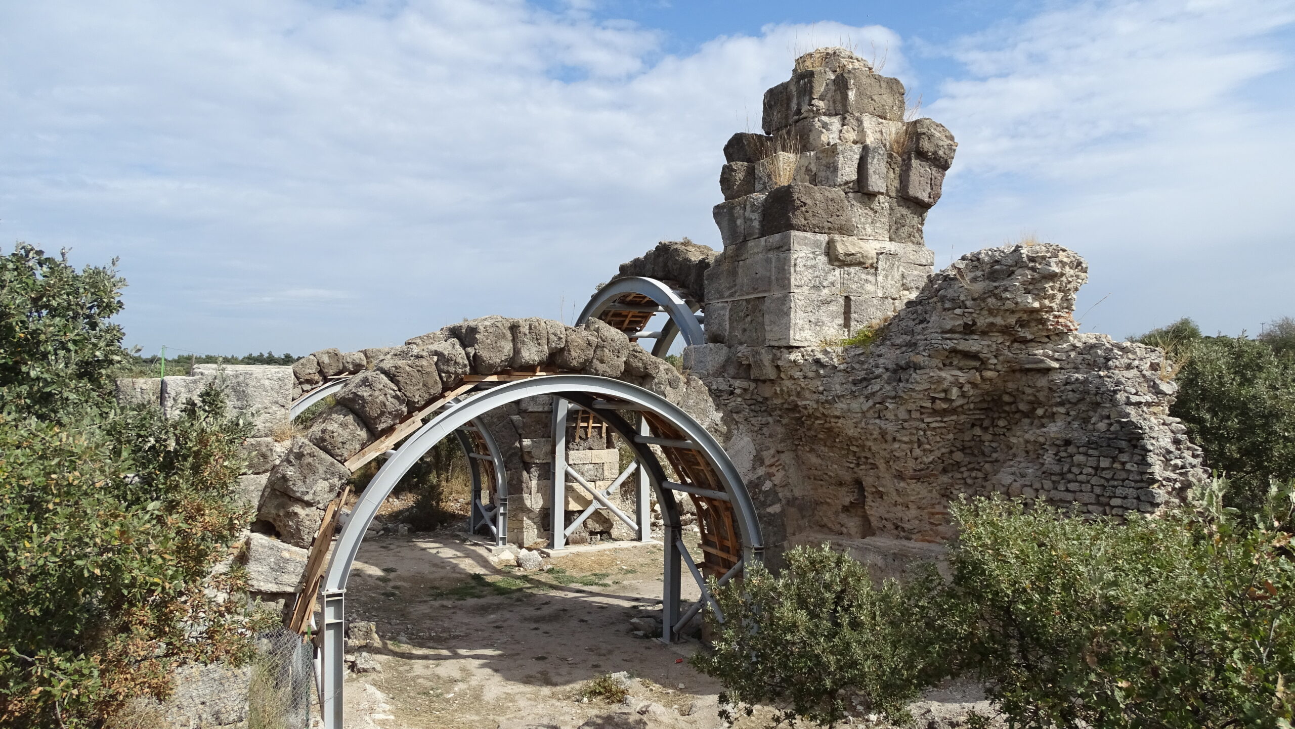
The ancient Roman Bridge stuck in the middle of fields on the way to Gülpınar was a worth-seeing artefact. The distance between the bridge and the first point that I saw it was around 300-400 m. I put my backpack down and went to the bridge through the fields to see it up close and to take photos. The dogs of course came with me. I went back and continued down the road after taking very nice photos with the dogs on the bridge. Soon after, I chuckled a lot when I realised that the route passed right next to the bridge.
I had taken so much trouble in vain. If I never took a break and went straight on, I would have come to the place where the bridge is already there.
The sun was about to set when I arrived at Gülpınar after finishing a 20-km route. Gülpınar is a touristic place. There are boarding houses to stay and restaurants to eat. I made a beeline to the Hektor boarding house and asked for a room when the people in a supermarket at the entrance of the town recommended it while I was looking for a place to stay.
When I settled in my room and looked out the window, I saw Diken sitting on the sidewalk opposite the boarding house and waiting. I finished that day with a hot shower, a nice meal, a proper bed and the sleep that followed.
First thing in the morning was to look out the window when I woke up. I was wondering if Diken was still there. I could not see Diken when I looked out the window. My days with Diken were over but I would miss Diken so much. I had my breakfast and hit the road again on the morning of the sixth day.
The next 12-km stage of the route passes through Kocaköy after Gülpınar and finishes at Bademli village. The last part of the route, which is 23 kms long, passes through Koyunevi, Bektaş and Koruoba after Bademli and finishes at Assos. The alternative route of the last section, which is 24 kms long, passes through Koyunevi, Bektaş and Korubaşı after Bademli and finishes at Assos. In this case, the sixth day would end with a short walk and the seventh and the last day would have a longer and more difficult stage. I decided to go to Bademli after Bektaş on the sixth day in order to make the last day’s stage more walkable.
The ancient city of Apollon Smintheus is located at the exit of Gülpınar. I have been to this place before so I carried on walking without delay. The route follows a gradually ascending track and you reach an altitude of 300 m above the sea level in Bademli. I took a break in both Kocaköy and Bademli. The people in the coffeehouses in both locations were not interested in me at all and did not ask me where I was from and where I was going. It means that while the people of some regions are curious, in some regions, outsiders do not attract much attention. Maybe, they do not want to disturb visiting strangers with their questions, who knows?
I arrived at Bektaş village by the end of the day with a 23-km walk. More precisely, I finished walking 500 m before the village. At that point, when a shepherd form the village I encountered told me that there was no place to set up a tent or a fountain near the village, I gave up going to the village and immediately pitched a tent next to an ancient well that the shepherd had shown. I met my water needs by drawing water from the well with the bucket given by the shepherd and of course I boiled the water I drew. The magnificent full moon view at night and the magnificent sunrise view over Bektaş village in the next morning were the rewards of my camping there.
I was in mixed feelings in the morning of the seventh day. I was both excited to finish the walk and arrive in Assos that day and I was sorry to come to the end of this seven-day-long adventure. I started off with these feelings.
The most challenging part for me at this stage was the part after Koruoba, where the fields ended, and the stony maquis shrub land started and continued along the ridge parallel to the seashore. The waymarks there somehow were mixed up or erased. The GPS application on the mobile phone stopped working at those points. I could not understand why some parts of the route, which zigzag continuously, did not go straight ahead when it was possible to proceed like that. Trying to move forward as the waymarks were lost during those manoeuvers pushed me quite a bit under the burning sun that was always on my face. In fact, I could not help myself and yelled my head off saying “enough is enough” 200 m before the Assos dig house where I made a hash of the route.
Additionally, this section of the route as described in the guidebook was an escape route for the refugees who want to go to the Lesbos Island illegally. There were clothes, shoes, packaging wastes, food and beverage containers scattered around which were left from the refugees. Mattresses made of cardboard for sleeping, blankets were all around. Life jackets that were worn to avoid drowning were also scattered around.
I felt like a refugee trying to flee abroad as I walked around there with my food and drink and tent in my backpack, down at the heels due to the seven-day hike.
While walking there, how they travel or try to travel to hope under harsh conditions, inevitably affects you. Seeing the coast guard boat sailing in the sea, it was impossible not to feel as if they were watching me; it seemed like a security guard or a gendarme would come out of somewhere and ask me what I was doing there. With these feelings, I found myself in front of the Assos Dig House by finishing this last 17-km stage. The Troy Culture Route, which started a week ago in Tevfikiye village, ended one week later in front of the Assos Dig House.
Who knows who had passed those roads in ancient times? Following the traces of the past, thinking about the people who lived in those times, walking around in the places they visited, touching the walls they touched revive feelings that are hard to describe.
People still live, walk and travel on the same land after thousands of years from those times. You too, go and see with your own eyes how those people before you lived, what they did, what today’s people are doing, how they live.
You can either hike the whole route with a backpack like I did, or you can daytrip some parts of it, but you should definitely experience the Troy Culture Route by yourself. And also who knows, maybe Diken accompanies you, too. How about that?
Hoping to meet you on other routes, may God speed you and may the red and white waymarks along the trail always be visible…
Oytun Güventürk
October 2019
https://www.instagram.com/tonyukukoytun/
https://www.wikiloc.com/wikiloc/user.do?id=2443661